Trip Report
Feather Peak - North Couloir - 9/12/10

by BMcC
Saturday September 25, 2010 12:26pm
My plans for climbing through the weekend after the Labor Day holiday were to wrap up with climbing the North Arete on Bear Creek Spire (BCS); however, work and other commitments conspired against my partners and made them unavailable. One partner learned of his conflicting commitment earlier in the week and dropped out. I didn't know whether my other partner would have Saturday (9/11) off until Friday after I finished scrambling up the NE Ridge on BCS (nope, he had to work).

With the weather forecast predicting great weekend weather, another project was in order and I had two days for it. My backup plan was to climb the North Couloir on Feather Peak (13,242').

Flanders posted a couple of nice Feather Couloir pictures on a Sierra ice conditions Supertopo thread and re-piqued my interest in doing the couloir (see his 8/27/10 post on this thread: http://www.supertopo.com/climbing/thread.php?topic_id=236419&tn=0&mr=0 ) I had also read Rob Yang's TR on his Feather epic and about the route in Moynier and Fiddler's "Sierra Classics - 100 Best Climbs in the High Sierra" guidebook.

On Friday (9/10), before learning that I did not have a partner for the N Arete on BCS, I had the pleasure of day hiking the NE Ridge on Bear Creek Spire with one of my brothers. http://www.supertopo.com/tr/NE-Ridge-on-Bear-Creek-Spire-9-10-10/t10764n.html Great views, some exposure in spots, and overall some fun scrambling and climbing. Our BCS adventure was about 11 miles round trip with about 3600' of elevation gain. From BCS, I got a good look at Feather Peak and decided that if my second BCS partner had to work Saturday, my weekend goal would be the North Couloir on Feather Peak. From the topo map, it looked to be approximately 17 miles round trip and to gain 6200' from the trailhead to the summit.

top left corner top right corner
North Couloir on Feather Peak as seen from Bear Creek Spire - 9/10/10
Credit: BMcC
bottom left corner bottom right corner

top left corner top right corner
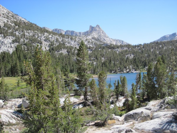
Upper Pine Lake - 9/11/10
Credit: BMcC
bottom left corner bottom right corner

top left corner top right corner
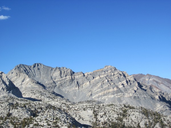
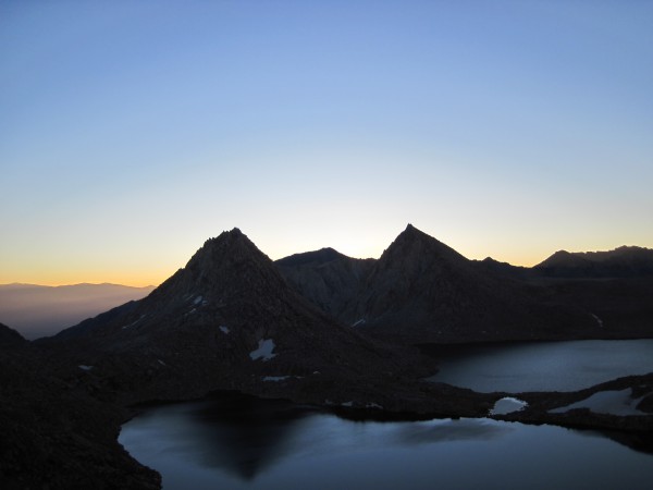
Peppermint Peak (12,680') - 9/11/10
Credit: BMcC
bottom left corner bottom right corner

top left corner top right corner
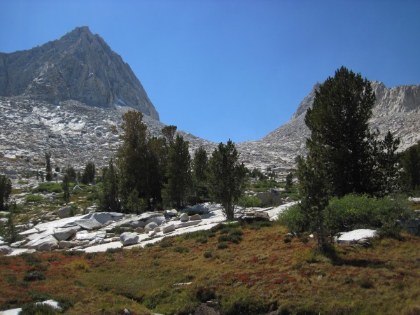
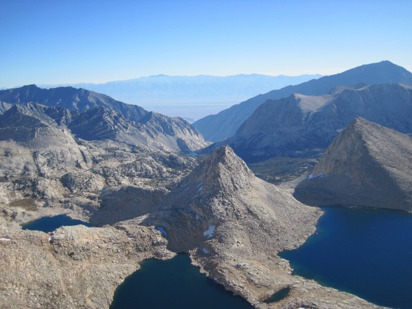
Royce Lakes and Feather, Royce, and Merriam Peaks are just beyond this...
Royce Lakes and Feather, Royce, and Merriam Peaks are just beyond this saddle (less than 3 miles away) - 9/11/10
Credit: BMcC
bottom left corner bottom right corner

top left corner top right corner
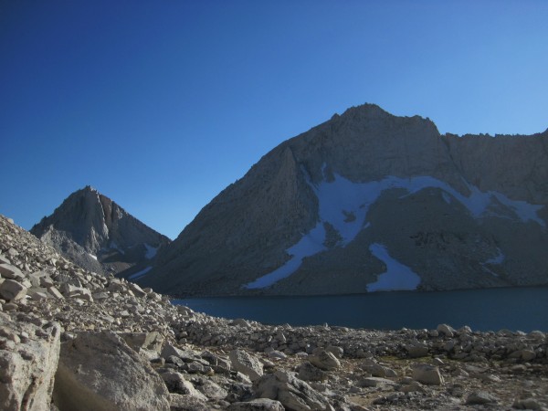
Merriam and Royce Peaks with the lower Royce Lake in the foreground - ...
Merriam and Royce Peaks with the lower Royce Lake in the foreground - 9/11/10
Credit: BMcC
bottom left corner bottom right corner

top left corner top right corner
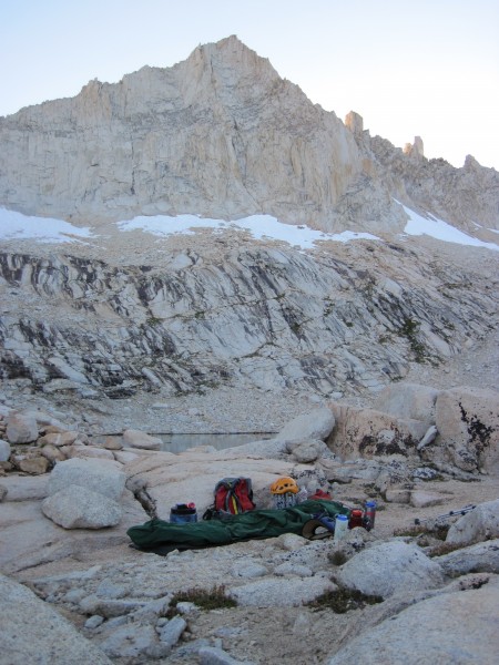
Bivy site in foreground; Feather Peak in the background; N Couloir sta...
Bivy site in foreground; Feather Peak in the background; N Couloir starts up from the rightmost snow patch - 9/11/10

Credit: BMcC
bottom left corner bottom right corner

top left corner top right corner
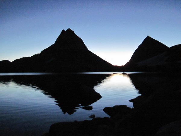
Morning light on Royce Lake - 9/11/10
Credit: BMcC
bottom left corner bottom right corner

top left corner top right corner
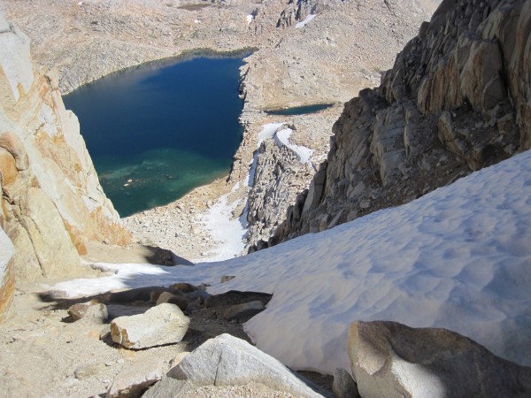
Royce Lakes from the toe of the snowfield below Feather Peak's N Coulo...
Royce Lakes from the toe of the snowfield below Feather Peak's N Couloir - 9/12/10
Credit: BMcC
bottom left corner bottom right corner

top left corner top right corner
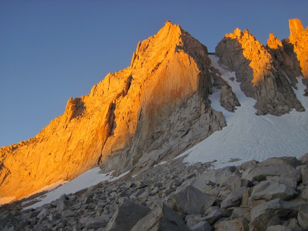
Sunrise lighting up Feather Peak - 9/12/10
Credit: BMcC
bottom left corner bottom right corner

top left corner top right corner
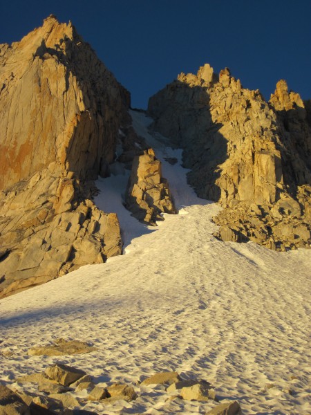
Looking up Feather Peak's North Couloir's left and right branches, and...
Looking up Feather Peak's North Couloir's left and right branches, and the rock buttress/island separating them. Note how the ice starts lower in the left branch - 9/12/10
Credit: BMcC
bottom left corner bottom right corner

top left corner top right corner
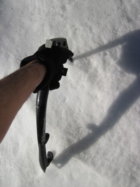
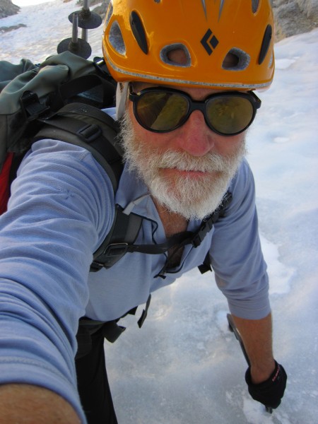
This mode of gripping my Cobras worked well for most of the styrofoam ...
This mode of gripping my Cobras worked well for most of the styrofoam snow (snice) leading up to the ice. Did some tool swinging on the actual ice - 9/12/10
Credit: BMcC
bottom left corner bottom right corner

top left corner top right corner
Looking up Feather Peak's North Couloir at its left and right branches...
Looking up Feather Peak's North Couloir at its left and right branches, and the rock buttress/island separating them. Decision time: do I go left where it runs out or right? - 9/12/10

Credit: BMcC
bottom left corner bottom right corner

I took the left branch since it looked like I would be on ice sooner than in the right branch:

top left corner top right corner
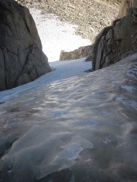
Looking back down the left branch of the Feather's N Couloir - 9/12/10
Credit: BMcC
bottom left corner bottom right corner

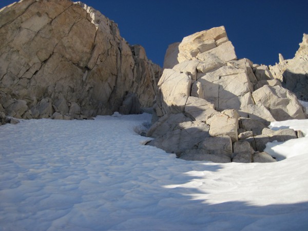
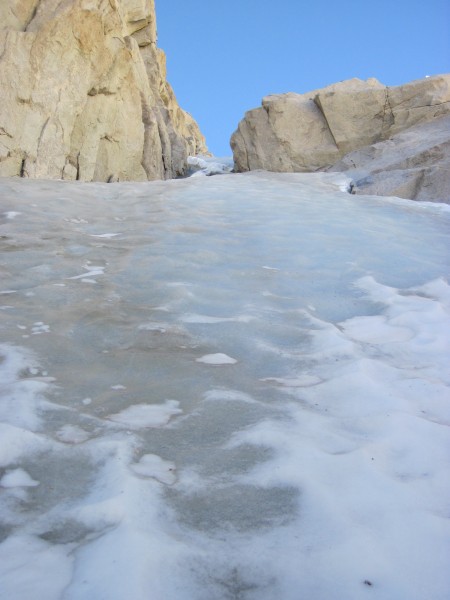
Looking up at the ice with the buttress on the right. The climbing is not done once the buttress is passed. If you go back to the first picture, you can see that the couloir continues for quite a ways above the rock buttress:

top left corner top right corner
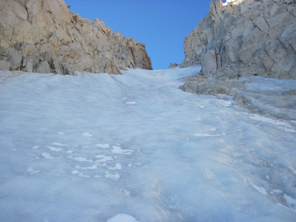
Fun ice above! Looking up the left branch of the Feather's N Couloir -...
Fun ice above! Looking up the left branch of the Feather's N Couloir - 9/12/10
Credit: BMcC
bottom left corner bottom right corner

top left corner top right corner
Passing the rock buttress, gaining some elevation - 9/12/10
Credit: BMcC
bottom left corner bottom right corner

top left corner top right corner
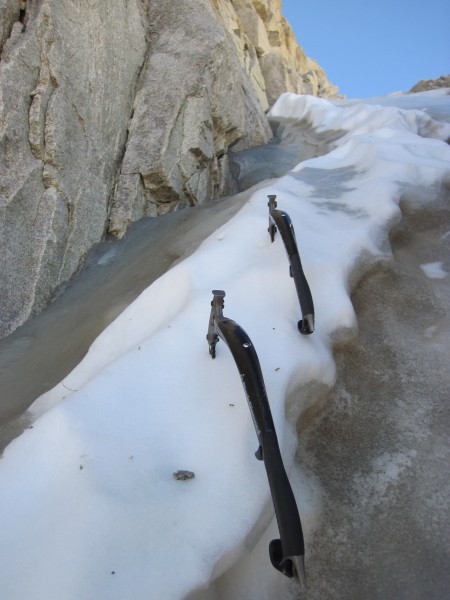
Tools parked in a convenient snow patch while I took a few pictures - ...
Tools parked in a convenient snow patch while I took a few pictures - 9/12/10
Credit: BMcC
bottom left corner bottom right corner

top left corner top right corner
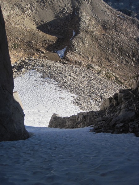
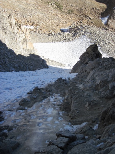
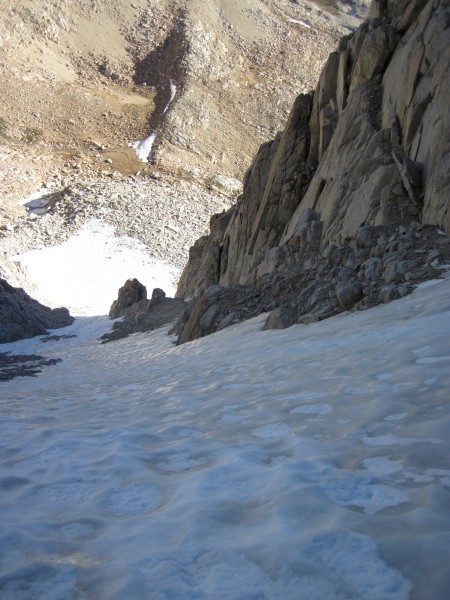
Looking down from my high point in the left branch of Feather Peak's N...
Looking down from my high point in the left branch of Feather Peak's N Couloir - 9/12/10
Credit: BMcC
bottom left corner bottom right corner

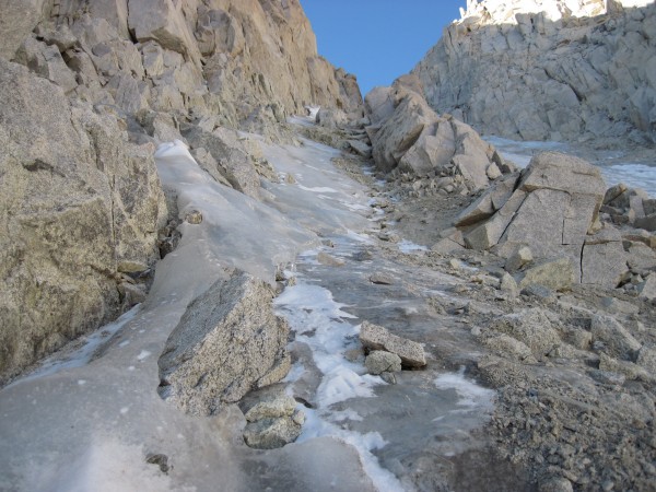
The ice was running out in the left branch, so I moved over into the right branch. Much of the loose-looking rock, sand, and gravel was actually still nicely frozen in place. I don't think I dislodged a single rock in my traverse:

top left corner top right corner
The left branch ice running out - 9/12/10
Credit: BMcC
bottom left corner bottom right corner

Getting into the right branch - less ice below than in the left branch:

top left corner top right corner
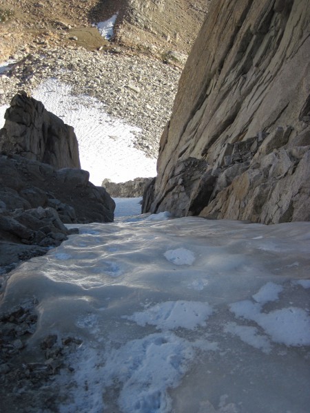
View down Feather's N Couloir right branch - 9/12/10 <br/>
View down Feather's N Couloir right branch - 9/12/10

Credit: BMcC
bottom left corner bottom right corner

top left corner top right corner
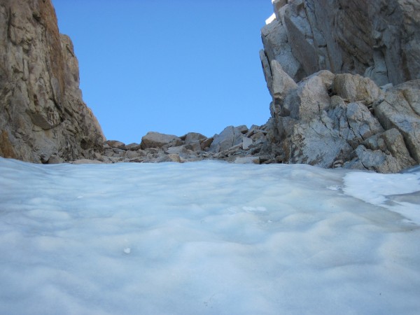
Nearing the steepest ice in the Feather Couloir - 9/12/10
Credit: BMcC
bottom left corner bottom right corner

top left corner top right corner
Almost up - 9/12/10
Almost up - 9/12/10
Credit: BMcC
bottom left corner bottom right corner

top left corner top right corner
A bit higher - 9/12/10
Credit: BMcC
bottom left corner bottom right corner

The end of the ice is nigh:

top left corner top right corner
Top of ice in Feather Peak's N Couloir - 9/12/10
Credit: BMcC
bottom left corner bottom right corner

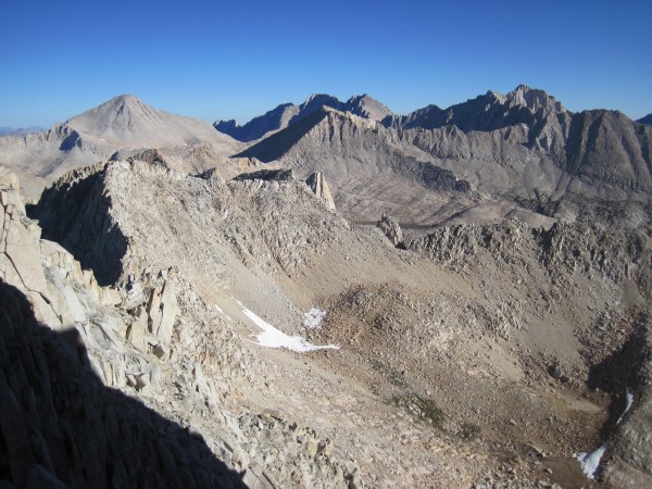
View from the top of the couloir included Bear Creek Spire:
top left corner top right corner
Bear Creek Spire from Feather Peak - 9/12/10
Credit: BMcC
bottom left corner bottom right corner

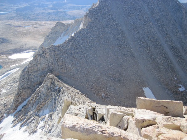
Hiked to the summit, checked out the summit register, and scoped out the descent:

top left corner top right corner
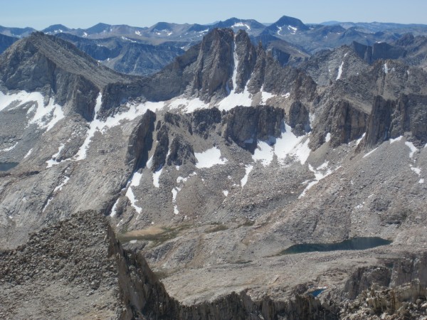
Descent gully &#40;at col between Royce and Feather&#41; is visible ne...
Descent gully (at col between Royce and Feather) is visible near the lower left corner of this picture - 9/12/10
Credit: BMcC
bottom left corner bottom right corner

Royce Lakes from the summit with the Pine Creek drainage stretching off into the distance from the middle of the picture:

top left corner top right corner
Royce Lakes - 9/12/10
Credit: BMcC
bottom left corner bottom right corner

Visible below this descent gully at the col between Feather and Royce Peaks is upper (left) Royce Lake and the land-bridge that separates it from the lower Royce Lake (out of view to the right). My camp was located about mid-way between the snow just above the middle of the picture and the puddle to the right of the lake. That puddle is actually the stream between the upper and lower lakes:

top left corner top right corner
The descent gully at the col between Feather and Royce Peaks - 9/12/10
Credit: BMcC
bottom left corner bottom right corner

Climbed down the gully to my camp, packed up and hiked out.


SUMMARY:

Feather Couloir ice conditions: easy styrofoam snow leading to fun ice. Good conditions and great views.
Weather - clear skies, mild temps, and very little wind (very unlike the weather I had just a few days earlier on North Peak). Perfect.

Crowd conditions: met a party of two at the Ranger station in Bishop while picking up my wilderness permit who indicated that they were going climb the couloir. I didn't see them again after starting up from the trailhead.

Trail: straight forward from trailhead through the stables (go in the gate, between the buildings, and up the trail), past the somewhat unpleasant looking tungsten mining operation (still active), climbing and leading to some nice scenery with Lower and then Upper Pine Lakes, followed by Honeymoon Lake, and cross-country hiking up slabs through the broad col leading to the Royce Lakes and Merriam, Royce, and Feather Peaks.

Misc. info for your general interest:
Guesstimating from a topographic map, it looked to be approximately 17 miles round trip and 6200' from trailhead to summit. For comparison: BCS was about 11 miles round trip and had about 3600' of elevation gain.
The hike from the trailhead to my camp between the Royce Lakes took 6 hours. Better route finding between Honeymoon and Royce Lakes could have shaved off a few tens of minutes, but I was in no hurry and meandered somewhat.
My approach hike from camp along the lake, past the couloir, and then up to the snow field below the couloir to where I geared up took one hour - interrupted by numerous stops to take pictures.
Had 72 minutes of fun with crampons and ice tools from my gear-up spot at the edge of the snowfield to the top of the ice in the couloir.
The descent from summit to camp was longer than I had hoped it would be (Rob Yang warned me it was long) at 2 and a half hours.
Total camp-to-summit-to-camp time was 6 hours.
Hike out was 4 and a half hours.

All of the aforementioned times could probably be significantly shortened had I been in a hurry. However, I had 2 days and no worries. Placing pro and belaying a partner up the couloir would have taken somewhat longer.

Seems to me that 2 days is perhaps a reasonable minimum time a team might devote to hiking in, camping overnight, and then climbing Feather Peak's N Couloir early the next day in order to also hike out. A 3rd day for the hike out might be nice for some teams.

Cheers!
  Trip Report Views: 6,100
BMcC
About the Author
BMcC is a trad climber from Livermore.

Comments
Mungeclimber

Trad climber
Nothing creative to say
  Sep 25, 2010 - 04:34am PT
sweet!


you east siders kill me tho!

:)
rhyang

climber
SJC
  Sep 25, 2010 - 10:05am PT
Nice work Bill !
philo

climber
  Sep 25, 2010 - 12:01pm PT
Beautiful climb! I would love to have been on it. Thanks for the wonderful photo tour.
phylp

Trad climber
Upland, CA
  Sep 26, 2010 - 12:38pm PT
Awesome!
Zoo

climber
Fremont, CA
  Sep 26, 2010 - 01:37pm PT
Great pictures. How steep is the ice?
Dirka

Trad climber
Hustle City
  Sep 26, 2010 - 04:37pm PT
Hell Yeah!
Risk

Mountain climber
Marooned, 855 miles from Tuolumne Meadows
  Sep 26, 2010 - 08:47pm PT
Now that's the really spectacular High Sierra! Looks remote, but reasonable for a long weekend.

Thanks for this great TR!
micronut

Trad climber
Fresno/Clovis, ca
  Sep 27, 2010 - 01:53am PT
Way to get out and get some wind in your beard. Well done. Thanks for sharing the adventure. You really chew through the terrain quick!
Alpine Raven

climber
Eugene, Oregon
  Sep 27, 2010 - 08:10pm PT
Nice going Bill. Great write-up and terrific photos. Is Feather N. couloir comparable to North Peak right couloir? Slope angle and length?

David
F10

Trad climber
Bishop
  Sep 27, 2010 - 08:16pm PT
Ice is Nice, thanks for the TR
Ezra Ellis

Trad climber
North wet, and Da souf
  Sep 28, 2010 - 03:40pm PT
Nice Pics, Thanks for sharing.
I love the lake pics especially!
Roxy

Trad climber
CA Central Coast
  Sep 28, 2010 - 03:45pm PT
awesome TR!
Unfrozen Caveman Lawyer

Trad climber
  Sep 28, 2010 - 04:29pm PT
Great write-up and pictures. Thanks for sharing.
aa-lex

climber
  Sep 28, 2010 - 04:30pm PT
Great work Bill!!
JEleazarian

Trad climber
Fresno CA
  Sep 28, 2010 - 04:34pm PT
Very nice TR. Thank you.

John
Fat Dad

Trad climber
Los Angeles, CA
  Sep 28, 2010 - 06:03pm PT
Sweet! Always wanted to do that one (yup), especially after checking it out from the summit of BCS after doing the NE Arete.

Thanks much for sharing.
JMC

climber
the land of milk and honey
  Sep 28, 2010 - 07:06pm PT
Thanks for posting up. Keep meaning to get up there, and you have only whetted my appetite further.
bmacd

Trad climber
100% Canadian
  Sep 28, 2010 - 07:34pm PT
what friendly mountains, no bush whacking. thanks for sharing
Zander

climber
  Sep 28, 2010 - 08:30pm PT
Great pics! Nice TR. Thanks,
Zander
mike m

Trad climber
black hills
  Sep 29, 2010 - 12:59am PT
Wow I can't wait for it to get cold!
BMcC

Trad climber
Livermore
Author's Reply  Oct 1, 2010 - 12:14am PT
Thanks(!) all for your comments.

Zoo and Alpine Ravine asked me about Feather's N Couloir steepness and how Feather's couloir compared to N Peak's rightmost couloir.

I'm guessing, but I would estimate that the two couloirs are comparable in angle at their steepest. I found that N Peak's couloir backs off to a relatively lowly and tiresome angle a ways from the top; whereas, Feather Peak's North Couloir steepens a bit before the ice runs out. As far as lengths of the routes, Feather's seemed longer and more continuous. Feather Peak's North Couloir and N Peak's rightmost couloir from where I started on the snow to the top of the ice took me 72 minutes and 54 minutes, respectively. That suggests that Feather's couloir is about 1/3 longer than N Peak's. Seems about right.
survival

Big Wall climber
Terrapin Station
  Oct 1, 2010 - 01:20am PT
Well done!

And beautiful pictures.

Thanks for posting this!
Go